
Drone Photography
High-Quality Media
Capture high-res content with precise composition and lighting — ideal for marketing, inspections, or construction progress tracking.
Framing & Focus
Optimize shots based on sun position, landmark orientation, and viewer perspective for beautiful and impactful visuals.

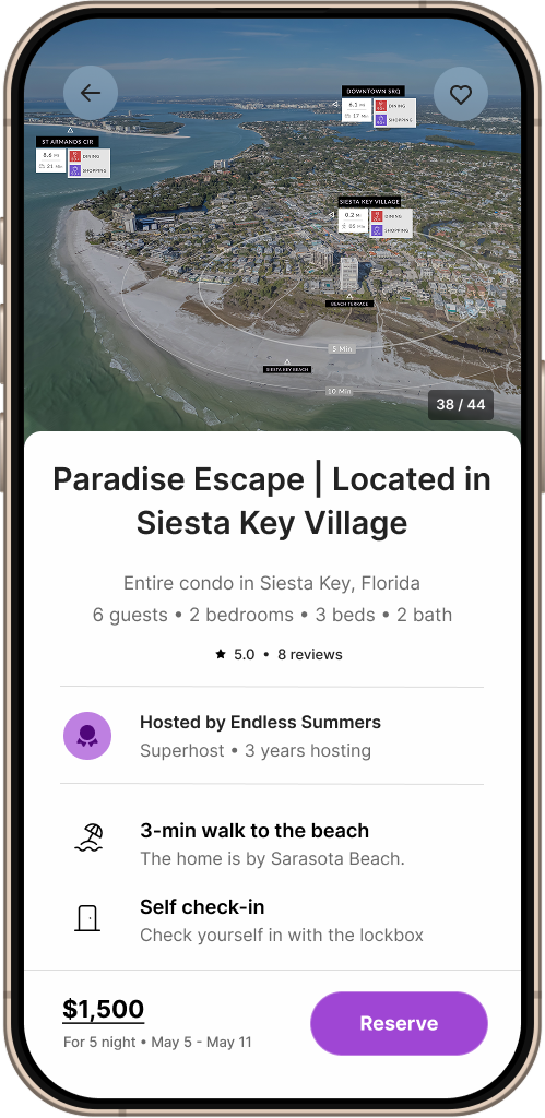
Aerial Infographics
Precise Location
Low-altitude views are perfect for highlighting specific areas. Enhance them with overlays showing travel times, proximity, and nearby hotspots.
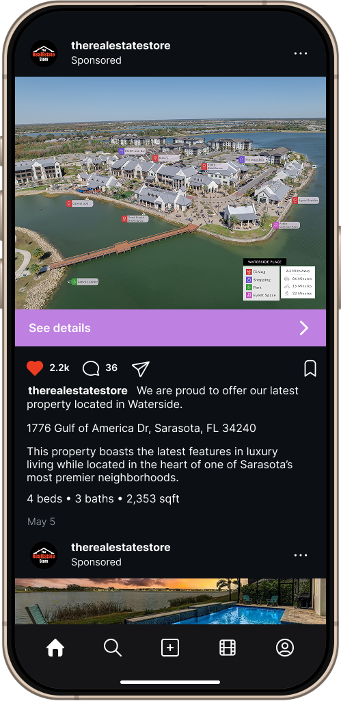
Broad Location
High-altitude views give spatial context but can retract focus. We add labeled landmarks, proximity visualizers, and structure highlighting to guide attention.
3D Mapping
Immersive Previews
Convert footage into 3D point clouds for interactive, spatially accurate representations — ideal for planning or promotion.
Contextual Modeling
Integrate real environments into virtual tools for construction, real estate, or event design with striking clarity and realism.
One Image. Total Perspective.
Marketing Ready – Replace bland stock media with striking visuals that make your listings pop.
Flexible Packages – Social media bundles available in multiple sizes to fit your goals.
Why Reach Out?
Quick Response – We usually reply within 24 hours (often sooner).
Local & Reliable – Based in Sarasota, serving the Gulf Coast with pride.
FAA Certified – Fully licensed for commercial drone operations.
Consulting – Unsure what your project needs? We'll guide you with clarity and expertise.